
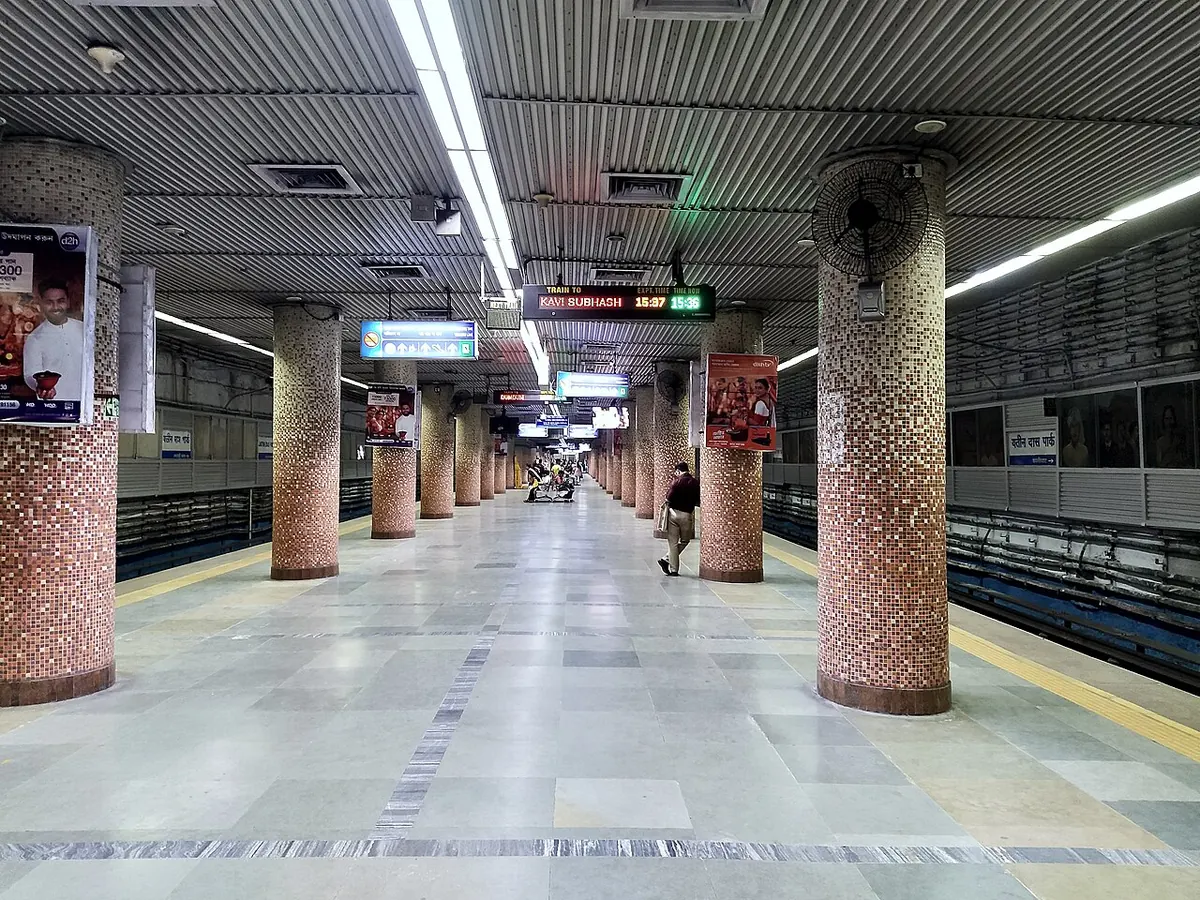
Nearest metro station to Asutosh College, Kolkata
Jatin Das Park is the nearest metro station to Asutosh College, about 132 m away, a walk of roughly 2 minutes.
Jatin Das Park metro station on the Blue Line is only 132 m from Asutosh College, about a 2 minute walk. Netaji Bhavan and Kalighat metro stations are the next options, at 892 m and 923 m, about 15 and 16 minutes on foot. Rabindra Sadan metro station is 1823 m away, roughly 32 minutes, so it is a long walk from here.
Tolly Ganj railway station is 1.9 km away, and New Alipur railway station and Lake Gardens railway station are both about 2.0 km away, each with 68 trains. From Dakshineshwar, Jatin Das Park metro station is about 37 minutes with no change. Jogomaya Devi College and Shyama Prasad College are close landmarks.
Metro stations near Asutosh College
| Station | Distance | First / last metro |
|---|---|---|
| Jatin Das Park Blue Line |
132 m 2 min walk |
06:20 to 23:07 |
| Netaji Bhavan Blue Line |
892 m 15 min walk |
06:22 to 23:05 |
| Kalighat Blue Line |
923 m 16 min walk |
06:18 to 23:09 |
| Rabindra Sadan Blue Line |
1.8 km 32 min walk |
06:24 to 23:04 |
Straight-line distance from the Asutosh College map point; the walk along roads is longer, so walking times are estimates.
Map


Tips for getting to Asutosh College
- Jatin Das Park metro station is about 2 minutes on foot, the best metro stop for this college.
- Tolly Ganj railway station is the nearest train stop at 1.9 km, with 68 trains.
- Riders from Noapara need about 30 minutes to reach Jatin Das Park metro station with no change.
Metro to Jatin Das Park (for Asutosh College) from popular stations
| From | Time | Changes |
|---|---|---|
| Dakshineshwar to Jatin Das Park | 37 min | Direct |
| Howrah Maidan to Jatin Das Park | 20 min | 1 |
| Noapara to Jatin Das Park | 30 min | Direct |
| Shahid Khudiram to Jatin Das Park | 20 min | Direct |
| Baranagar to Jatin Das Park | 34 min | Direct |
| Belgachia to Jatin Das Park | 22 min | Direct |
Nearest railway station to Asutosh College
| Railway station | Distance | Trains |
|---|---|---|
| Tolly Ganj (TLG) | 1.9 km | 68 |
| New Alipur (NACC) | 2.0 km | 68 |
| Lake Gardens (LKF) | 2.0 km | 68 |
Straight-line distance. Train counts are trains that stop at the station in our timetable.
Buses near Asutosh College
| Bus stop | Distance | Buses |
|---|---|---|
| Jatin Das Park 4 min walk | 213 m | 1, 1A, 3B, 3C/1, 12C/1B, 13A, 13C, 17 and 42 more |
Nearest bus stand: Calcutta State Transport Corporation Depot, about 2.2 km away.
Straight-line distance; walking time adds a little for streets. Bus routes are from OpenStreetMap.
Questions about getting to Asutosh College
What is the walk from Jatin Das Park metro station to Asutosh College?
It is about 132 m in a straight line, roughly a 2 minute walk.
Which line runs past Asutosh College?
The Blue Line. Netaji Bhavan, Kalighat and Rabindra Sadan metro stations are on it too.
How far is Tolly Ganj railway station from Asutosh College?
About 1.9 km away, with 68 trains.
Which is the nearest metro station to Asutosh College?
Jatin Das Park on the Blue Line (Kolkata Metro) is the nearest metro station to Asutosh College, about 132 m away in a straight line, roughly a 2 minute walk.
Is there another metro station near Asutosh College?
Yes. Netaji Bhavan is about 892 m away (Kolkata Metro).
Which is the nearest railway station to Asutosh College?
Tolly Ganj (TLG) is the nearest railway station, about 1.9 km away, with 68 trains stopping there.
Which buses stop near Asutosh College?
Jatin Das Park bus stop is about 213 m from Asutosh College, roughly a 4 minute walk. Routes 1, 1A, 3B, 3C/1, 12C/1B and 13A stop there in our data.
Which is the nearest bus stand to Asutosh College?
Calcutta State Transport Corporation Depot is about 2.2 km from Asutosh College in a straight line.
Timings and fares: Metro Railway, Kolkata (Indian Railways) (official site), checked 2026-10-03. Times at intermediate stations are estimates. Station locations: OpenStreetMap contributors. Not affiliated with any metro operator.
Place location: OpenStreetMap.