
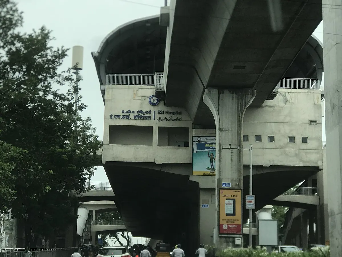
Nearest metro station to Government General and Chest Hospital, Hyderabad
ESI Hospital is the nearest metro station to Government General and Chest Hospital, about 439 m away, a walk of roughly 8 minutes.
ESI Hospital metro station, on the Red Line, is the closest stop at 439 m, which takes about 8 minutes on foot. S. R. Nagar metro station, also on the Red Line, is 824 m away. If you are on the Blue Line, Madhura Nagar metro station at 1031 m is the one to use, about 18 minutes on foot.
Sanatnagar railway station (1.8 km, 20 trains) and Bharatnagar railway station (1.9 km, 61 trains) are the nearest railway stations. Nature Cure Hospital railway station is 1.9 km away with 59 trains. A metro ride from Ameerpet to ESI Hospital takes about 3 minutes with no change. DTC TB Unit Erragadda is close by as a landmark.
Metro stations near Government General and Chest Hospital
| Station | Distance | First / last metro |
|---|---|---|
| ESI Hospital Red Line |
439 m 8 min walk |
06:20 to 23:35 |
| S. R. Nagar Red Line |
824 m 14 min walk |
06:21 to 23:34 |
| Madhura Nagar Blue Line |
1.0 km 18 min walk |
06:16 to 23:32 |
| Erragadda Red Line |
1.3 km 23 min walk |
06:17 to 23:38 |
Straight-line distance from the Government General and Chest Hospital map point; the walk along roads is longer, so walking times are estimates.
Map


Tips for getting to Government General and Chest Hospital
- Choose ESI Hospital metro station for the shortest walk, about 8 minutes.
- Madhura Nagar metro station is on the Blue Line, so it suits riders already on that line.
- Bharatnagar railway station has more trains than Sanatnagar, 61 against 20.
Metro to ESI Hospital (for Government General and Chest Hospital) from popular stations
| From | Time | Changes |
|---|---|---|
| Mahatma Gandhi Bus Station to ESI Hospital | 20 min | Direct |
| Parade Grounds to ESI Hospital | 19 min | 1 |
| Ameerpet to ESI Hospital | 3 min | Direct |
| Assembly to ESI Hospital | 13 min | Direct |
| Begumpet to ESI Hospital | 10 min | 1 |
| Bharat Nagar to ESI Hospital | 4 min | Direct |
Nearest railway station to Government General and Chest Hospital
| Railway station | Distance | Trains |
|---|---|---|
| Sanatnagar (SNF) | 1.8 km | 20 |
| Nature Cure Hospital (NCHS) | 1.9 km | 59 |
| Bharatnagar (BTNR) | 1.9 km | 61 |
Straight-line distance. Train counts are trains that stop at the station in our timetable.
Nearest bus stand to Government General and Chest Hospital
Nearest bus stand: police line bus stop, about 1.5 km away.
Straight-line distance; walking time adds a little for streets. Bus routes are from OpenStreetMap.
Questions about getting to Government General and Chest Hospital
How long is the walk from ESI Hospital metro station to this hospital?
About 439 m, which is roughly 8 minutes on foot.
Is S. R. Nagar metro station on the Red Line?
Yes, S. R. Nagar is a Red Line station, about 824 m from the hospital.
Which railway station has the most trains near this hospital?
Bharatnagar railway station, with 61 trains, about 1.9 km away.
Which is the nearest metro station to Government General and Chest Hospital?
ESI Hospital on the Red Line (Hyderabad Metro) is the nearest metro station to Government General and Chest Hospital, about 439 m away in a straight line, roughly a 8 minute walk.
Is there another metro station near Government General and Chest Hospital?
Yes. S. R. Nagar is about 824 m away (Hyderabad Metro).
Which is the nearest railway station to Government General and Chest Hospital?
Sanatnagar (SNF) is the nearest railway station, about 1.8 km away, with 20 trains stopping there.
Which is the nearest bus stand to Government General and Chest Hospital?
police line bus stop is about 1.5 km from Government General and Chest Hospital in a straight line.
Timings and fares: L&T Metro Rail (Hyderabad) Limited, now 100% owned by Hyderabad Metro Rail Limited (Government of Telangana) after the L&T divestment agreement of 29 April 2026 (official site), checked 2026-10-03. Times at intermediate stations are estimates. Station locations: OpenStreetMap contributors. Not affiliated with any metro operator.
Place location: OpenStreetMap.