
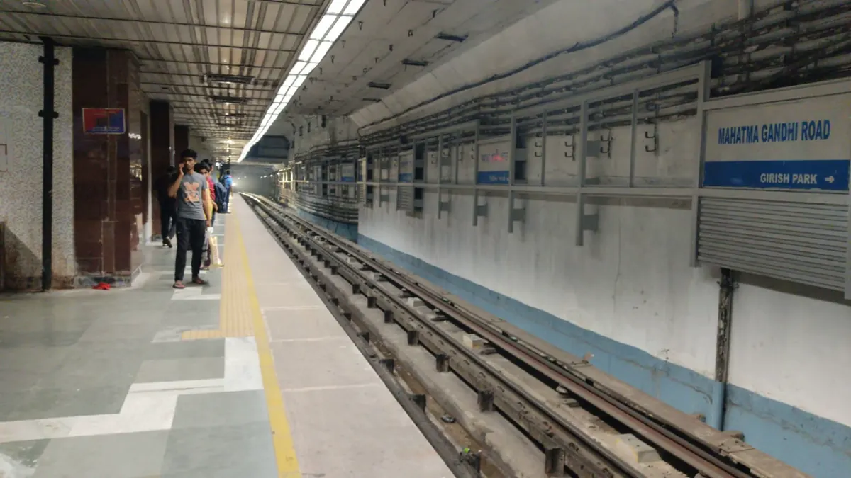
Nearest metro station to Hospital, Bengaluru
Mahatma Gandhi Road is the nearest metro station to Hospital, about 1.9 km away, a walk of roughly 32 minutes.
Mahatma Gandhi Road metro station on the Purple Line is the nearest to this Hospital, about 1851 m away, a walk of about 32 minutes. Cubbon Park metro station, also on the Purple Line, is at 1930 m, and Trinity metro station at 2126 m. Halasuru metro station, at 2320 m, is the longest walk here.
Bangalore East railway station is the nearest at 1.3 km, with 27 trains. Bangalore Cant railway station is 1.4 km away and has the most trains (95). Banaswadi railway station is 2.4 km away with 29 trains. From Majestic metro station, Mahatma Gandhi Road metro station is about 8 minutes with no change. St. John's Church and Coles Park are nearby.
Metro stations near Hospital
| Station | Distance | First / last metro |
|---|---|---|
| Mahatma Gandhi Road Purple Line |
1.9 km 32 min walk |
05:41 to 23:44 |
| Cubbon Park Purple Line |
1.9 km 33 min walk |
05:39 to 23:41 |
| Trinity Purple Line |
2.1 km 37 min walk |
05:38 to 23:46 |
| Halasuru Purple Line |
2.3 km 40 min walk |
05:36 to 23:48 |
Straight-line distance from the Hospital map point; the walk along roads is longer, so walking times are estimates.
Map


Tips for getting to Hospital
- Mahatma Gandhi Road metro station is the closest, at 1851 m on the Purple Line.
- Cubbon Park metro station, 1930 m away, is a close second on the same line.
- Bangalore Cant railway station is just 1.4 km away with 95 trains, the most here.
- From Kengeri Bus Terminal metro station, Mahatma Gandhi Road metro station is about 34 minutes with no change.
Metro to Mahatma Gandhi Road (for Hospital) from popular stations
| From | Time | Changes |
|---|---|---|
| Kengeri Bus Terminal to Mahatma Gandhi Road | 34 min | Direct |
| Majestic to Mahatma Gandhi Road | 8 min | Direct |
| Rashtreeya Vidyalaya Road to Mahatma Gandhi Road | 25 min | 1 |
| Whitefield (Kadugodi) to Mahatma Gandhi Road | 41 min | Direct |
| Attiguppe to Mahatma Gandhi Road | 18 min | Direct |
| Baiyappanahalli to Mahatma Gandhi Road | 11 min | Direct |
Nearest railway station to Hospital
| Railway station | Distance | Trains |
|---|---|---|
| Bangalore East (BNCE) | 1.3 km | 27 |
| Bangalore Cant (BNC) | 1.4 km | 95 |
| Banaswadi (BAND) | 2.4 km | 29 |
Straight-line distance. Train counts are trains that stop at the station in our timetable.
Buses near Hospital
| Bus stop | Distance | Buses |
|---|---|---|
| Thomas Cafe 4 min walk | 233 m | KIA4, KIA4A |
| Thoms Bakery 5 min walk | 270 m | 169, TR7 |
| Sivanchetty Gardens 8 min walk | 439 m | 169, TR7 |
| Seventh Day School 8 min walk | 482 m | 300MV |
Nearest bus stand: Shivajinagar Bus Station, about 1.3 km away.
Straight-line distance; walking time adds a little for streets. Bus routes are from OpenStreetMap.
Questions about getting to Hospital
What is the walking time from Mahatma Gandhi Road metro station?
About 32 minutes for the 1851 m, measured in a straight line.
Which railway station is nearest to this Hospital?
Bangalore East railway station, about 1.3 km away, with 27 trains. Bangalore Cant railway station is 1.4 km away with 95 trains.
Is Cubbon Park metro station walkable?
It is 1930 m away, roughly 33 minutes on foot.
Which is the nearest metro station to Hospital?
Mahatma Gandhi Road on the Purple Line (Namma Metro) is the nearest metro station to Hospital, about 1.9 km away in a straight line, roughly a 32 minute walk.
Is there another metro station near Hospital?
Yes. Cubbon Park is about 1.9 km away (Namma Metro).
Which is the nearest railway station to Hospital?
Bangalore East (BNCE) is the nearest railway station, about 1.3 km away, with 27 trains stopping there.
Which buses stop near Hospital?
Thomas Cafe bus stop is about 233 m from Hospital, roughly a 4 minute walk. Routes KIA4 and KIA4A stop there in our data.
Which is the nearest bus stand to Hospital?
Shivajinagar Bus Station is about 1.3 km from Hospital in a straight line.
Timings and fares: Bangalore Metro Rail Corporation Limited (BMRCL) (official site), checked 2026-11-15. Times at intermediate stations are estimates. Station locations: OpenStreetMap contributors. Not affiliated with any metro operator.
Place location: OpenStreetMap.