
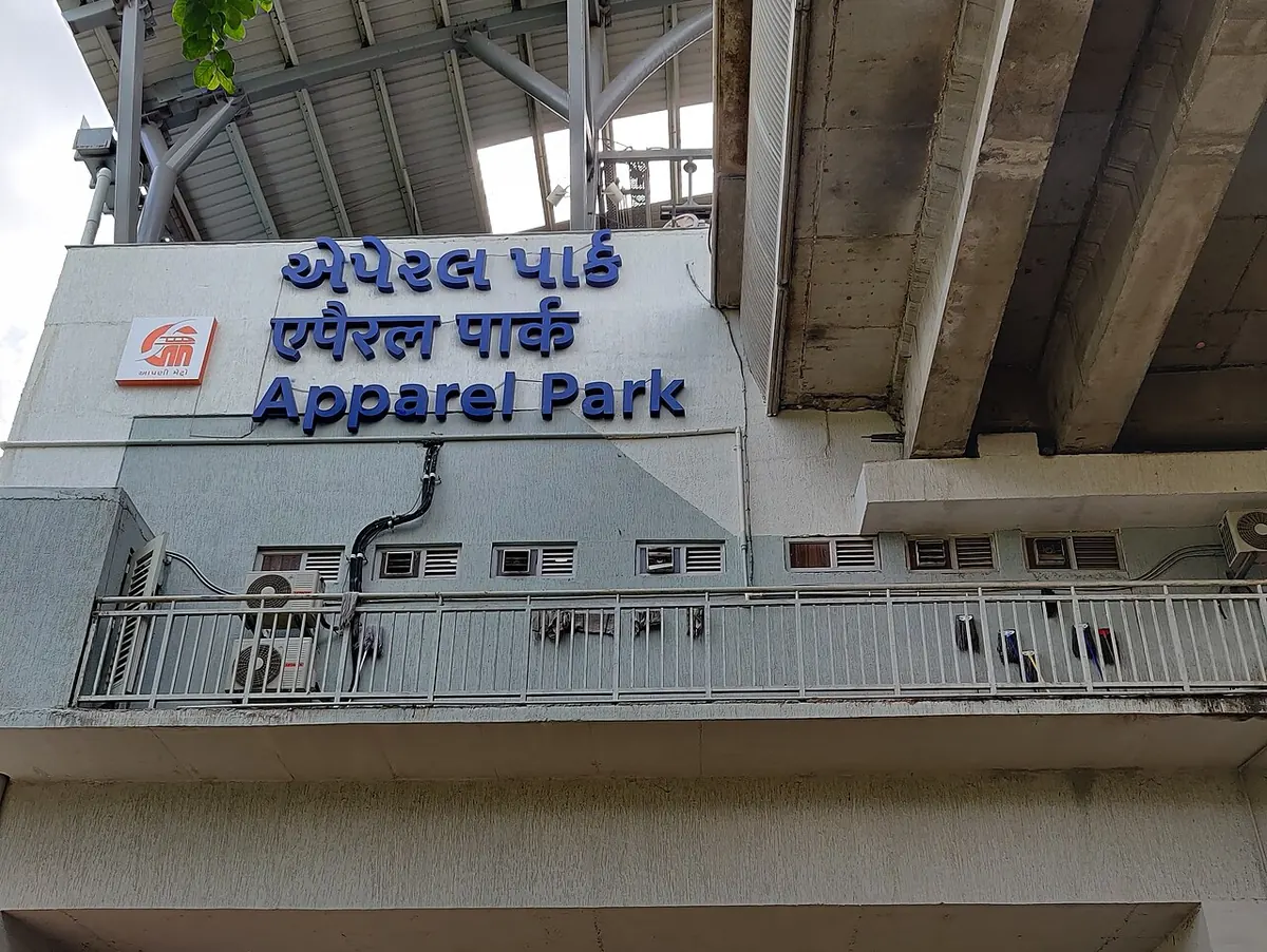
Nearest metro station to Kamal Hospital, Ahmedabad
Apparel Park is the nearest metro station to Kamal Hospital, Ahmedabad, about 1.9 km away, a walk of roughly 33 minutes.
Apparel Park metro station on the Blue Line is the nearest to Kamal Hospital, about 1.9 km away with a walk of about 33 minutes. Amraiwadi metro station and Kankaria East metro station are on the same line, at about 2.2 km and 2.4 km, so you can use whichever is easier to reach. Rabari Colony metro station is about 2.7 km away with a walk of about 47 minutes.
Maninagar railway station is only about 0.6 km from the hospital, with 39 trains listed, so it is the closest train stop by a good margin. Ahmedabad Jn railway station is about 3.6 km off and has more trains (298), so it suits longer journeys. Vatva railway station is about 4.3 km away with 17 trains. Dalal Colony and Ahmedabad Medical Centre are nearby places to look for.
Metro stations near Kamal Hospital, Ahmedabad
| Station | Distance | First / last metro |
|---|---|---|
| Apparel Park Blue Line (Line 1, East-West Corridor) |
1.9 km 33 min walk |
06:33 to 23:32 |
| Amraiwadi Blue Line (Line 1, East-West Corridor) |
2.2 km 39 min walk |
06:30 to 23:35 |
| Kankaria East Blue Line (Line 1, East-West Corridor) |
2.4 km 41 min walk |
06:36 to 23:29 |
| Rabari Colony Blue Line (Line 1, East-West Corridor) |
2.7 km 47 min walk |
06:28 to 23:37 |
Straight-line distance from the Kamal Hospital, Ahmedabad map point; the walk along roads is longer, so walking times are estimates.
Map


Tips for getting to Kamal Hospital, Ahmedabad
- Apparel Park metro station is about 1.9 km away, a walk of about 33 minutes.
- Maninagar railway station is only about 0.6 km away and has 39 trains listed.
- Kankaria East metro station is another Blue Line option, about 2.4 km away.
Metro to Apparel Park (for Kamal Hospital, Ahmedabad) from popular stations
| From | Time | Changes |
|---|---|---|
| GNLU to Apparel Park | 1 h 2 min | 2 |
| Koteshwar Road to Apparel Park | 42 min | 1 |
| Mahatma Mandir to Apparel Park | 1 h 29 min | 2 |
| AEC to Apparel Park | 34 min | 1 |
| Gandhigram to Apparel Park | 23 min | 1 |
| Kalupur Railway Station to Apparel Park | 6 min | Direct |
Nearest railway station to Kamal Hospital, Ahmedabad
| Railway station | Distance | Trains |
|---|---|---|
| Maninagar (MAN) | 0.6 km | 37 |
| Ahmedabad Jn (ADI) | 3.6 km | 296 |
| Vatva (VTA) | 4.3 km | 18 |
Straight-line distance. Train counts are trains that stop at the station in our timetable.
Nearest bus stand to Kamal Hospital, Ahmedabad
Nearest bus stand: Maninagar Railway Station, about 456 m away.
Straight-line distance; walking time adds a little for streets. Bus routes are from OpenStreetMap.
Questions about getting to Kamal Hospital, Ahmedabad
How far is Amraiwadi metro station from Kamal Hospital?
About 2.2 km in a straight line, with a walk of about 39 minutes.
Is Maninagar railway station close to Kamal Hospital?
Yes, it is about 0.6 km away and has 39 trains listed.
Which metro line goes to Kamal Hospital, Ahmedabad?
The Blue Line. Apparel Park metro station, Amraiwadi metro station, Kankaria East metro station and Rabari Colony metro station are all on it.
Which is the nearest metro station to Kamal Hospital, Ahmedabad?
Apparel Park on the Blue Line (Line 1, East-West Corridor) (Ahmedabad Metro (Ahmedabad-Gandhinagar)) is the nearest metro station to Kamal Hospital, Ahmedabad, about 1.9 km away in a straight line, roughly a 33 minute walk.
Is there another metro station near Kamal Hospital, Ahmedabad?
Yes. Amraiwadi is about 2.2 km away (Ahmedabad Metro (Ahmedabad-Gandhinagar)).
Which is the nearest railway station to Kamal Hospital, Ahmedabad?
Maninagar (MAN) is the nearest railway station, about 0.6 km away, with 37 trains stopping there.
Which is the nearest bus stand to Kamal Hospital, Ahmedabad?
Maninagar Railway Station is about 456 m from Kamal Hospital, Ahmedabad in a straight line.
Timings and fares: Gujarat Metro Rail Corporation Ltd (GMRC) (official site), checked 2026-10-03. Times at intermediate stations are estimates. Station locations: OpenStreetMap contributors. Not affiliated with any metro operator.
Place location: OpenStreetMap.