
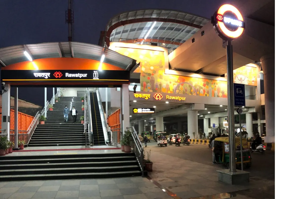
Nearest metro station to L.P.S . Institute Of Cardilogy, Kanpur
Rawatpur is the nearest metro station to L.P.S . Institute Of Cardilogy, about 382 m away, a walk of roughly 7 minutes.
Rawatpur metro station is the nearest Orange Line stop to L.P.S . Institute Of Cardilogy, about 383 m away, a walk of roughly 7 minutes. LLR Hospital is the next option at 836 m, around 14 minutes on foot. Geeta Nagar and Moti Jheel are about 1.3 km and 1.5 km off, with walks of 22 and 25 minutes, so the first two are the practical picks.
Rawatpur railway station is about 0.6 km away and has 16 trains, the closest railway station here. Govindpuri railway station is about 3.1 km away with 152 trains, so it has more trains, and Kanpur Anwrganj railway station is about 3.7 km off with 46 trains. From Geeta Nagar, Rawatpur is about 2 minutes by metro with no change. Mahendru Hospital and Regency Hospital are nearby landmarks.
Metro stations near L.P.S . Institute Of Cardilogy
| Station | Distance | First / last metro |
|---|---|---|
| Rawatpur Orange Line |
382 m 7 min walk |
06:12 to 22:16 |
| LLR Hospital Orange Line |
836 m 14 min walk |
06:14 to 22:14 |
| Geeta Nagar Orange Line |
1.3 km 22 min walk |
06:10 to 22:18 |
| Moti Jheel Orange Line |
1.5 km 25 min walk |
06:12 to 22:16 |
Straight-line distance from the L.P.S . Institute Of Cardilogy map point; the walk along roads is longer, so walking times are estimates.
Map


Tips for getting to L.P.S . Institute Of Cardilogy
- Rawatpur metro station is about 383 m away, a walk of roughly 7 minutes.
- LLR Hospital metro station is the second choice at about 836 m, around 14 minutes on foot.
- Rawatpur railway station is about 0.6 km away and has 16 trains.
- Geeta Nagar to Rawatpur is about 2 minutes by metro with no change.
Metro to Rawatpur (for L.P.S . Institute Of Cardilogy) from popular stations
| From | Time | Changes |
|---|---|---|
| Kanpur Central to Rawatpur | 16 min | Direct |
| IIT Kanpur to Rawatpur | 12 min | Direct |
| Geeta Nagar to Rawatpur | 2 min | Direct |
| Kalyanpur to Rawatpur | 10 min | Direct |
| SPM Hospital to Rawatpur | 9 min | Direct |
| Bada Chauraha to Rawatpur | 11 min | Direct |
Nearest railway station to L.P.S . Institute Of Cardilogy
| Railway station | Distance | Trains |
|---|---|---|
| Rawatpur (RPO) | 0.6 km | 16 |
| Govindpuri (GOY) | 3.1 km | 153 |
| Kanpur Anwrganj (CPA) | 3.7 km | 46 |
Straight-line distance. Train counts are trains that stop at the station in our timetable.
Nearest bus stand to L.P.S . Institute Of Cardilogy
Nearest bus stand: Kalpana travels, about 2.2 km away.
Straight-line distance; walking time adds a little for streets. Bus routes are from OpenStreetMap.
Questions about getting to L.P.S . Institute Of Cardilogy
How far is L.P.S . Institute Of Cardilogy from Rawatpur metro station?
About 383 m in a straight line, roughly 7 minutes on foot.
Can I walk from LLR Hospital metro station to L.P.S . Institute Of Cardilogy?
It is about 836 m, roughly 14 minutes on foot. Walk times are estimates, so leave a little slack.
Where is the closest railway station to L.P.S . Institute Of Cardilogy?
Rawatpur railway station, about 0.6 km away with 16 trains.
Which is the nearest metro station to L.P.S . Institute Of Cardilogy?
Rawatpur on the Orange Line (Kanpur Metro) is the nearest metro station to L.P.S . Institute Of Cardilogy, about 382 m away in a straight line, roughly a 7 minute walk.
Is there another metro station near L.P.S . Institute Of Cardilogy?
Yes. LLR Hospital is about 836 m away (Kanpur Metro).
Which is the nearest railway station to L.P.S . Institute Of Cardilogy?
Rawatpur (RPO) is the nearest railway station, about 0.6 km away, with 16 trains stopping there.
Which is the nearest bus stand to L.P.S . Institute Of Cardilogy?
Kalpana travels is about 2.2 km from L.P.S . Institute Of Cardilogy in a straight line.
Timings and fares: Uttar Pradesh Metro Rail Corporation (UPMRC) (official site), checked 2026-10-03. Times at intermediate stations are estimates. Station locations: OpenStreetMap contributors. Not affiliated with any metro operator.
Place location: OpenStreetMap.