
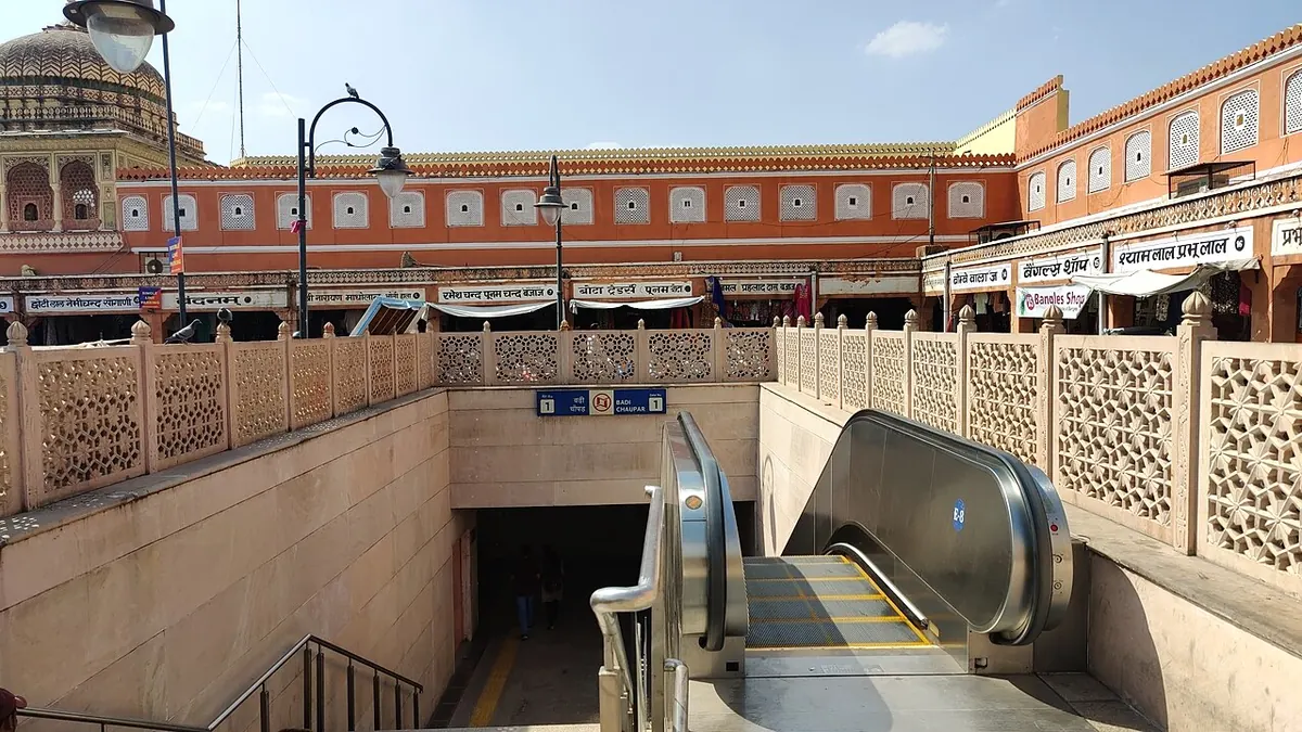
Nearest metro station to M.D. Hospital, Jaipur
Badi Chaupar is the nearest metro station to M.D. Hospital, about 1.2 km away, a walk of roughly 21 minutes.
Badi Chaupar metro station is the nearest to M.D. Hospital, 1184 m away and about 21 minutes on foot. Choti Chaupar is 1485 m away, about 26 minutes, and Chandpole is 2280 m away, about 40 minutes. Sindhi Camp, at 2698 m, is the furthest and takes about 47 minutes to walk.
Of the three railway stations nearby, Jaipur Jn is 3.8 km away and has the most trains, 294. Gandhinagar Jaipur is 5.1 km away with 107 trains, and Dahar KA Balaji is 6.8 km away with 32 trains. From Railway Station metro station, Badi Chaupar is about 10 minutes by metro with no change. Sanganeri Gate and Mahila Chikitsalya are close by.
Metro stations near M.D. Hospital
| Station | Distance | First / last metro |
|---|---|---|
| Badi Chaupar Pink Line |
1.2 km 21 min walk |
05:20 to 22:21 |
| Choti Chaupar Pink Line |
1.5 km 26 min walk |
05:22 to 22:45 |
| Chandpole Pink Line |
2.3 km 40 min walk |
05:25 to 22:42 |
| Sindhi Camp Pink Line |
2.7 km 47 min walk |
05:27 to 22:40 |
Straight-line distance from the M.D. Hospital map point; the walk along roads is longer, so walking times are estimates.
Map


Tips for getting to M.D. Hospital
- Badi Chaupar metro station is 1184 m away, about 21 minutes on foot.
- Choti Chaupar metro station, 1485 m away, is about 26 minutes on foot.
- Jaipur Jn railway station is 3.8 km away with 294 trains.
- From Chandpole metro station, Badi Chaupar takes about 5 minutes with no change.
Metro to Badi Chaupar (for M.D. Hospital) from popular stations
| From | Time | Changes |
|---|---|---|
| Railway Station to Badi Chaupar | 10 min | Direct |
| Manasarovar to Badi Chaupar | 26 min | Direct |
| Chandpole to Badi Chaupar | 5 min | Direct |
| Choti Chaupar to Badi Chaupar | 2 min | Direct |
| Civil Lines to Badi Chaupar | 13 min | Direct |
| New Aatish Market to Badi Chaupar | 22 min | Direct |
Nearest railway station to M.D. Hospital
| Railway station | Distance | Trains |
|---|---|---|
| Jaipur Jn (JP) | 3.8 km | 297 |
| Gandhinagar Jaipur (GADJ) | 5.1 km | 108 |
| Dahar KA Balaji (DKBJ) | 6.8 km | 33 |
Straight-line distance. Train counts are trains that stop at the station in our timetable.
Buses near M.D. Hospital
| Bus stop | Distance | Buses |
|---|---|---|
| Sanganeri Gate 5 min walk | 316 m | 1A, 3, 3A, 3B, 14, 34, AC 1 |
| New Gate Circle 10 min walk | 553 m | 1A, 3, 3A, 3B, 14, 34, AC 1 |
Nearest bus stand: Volvo Stand, about 1.8 km away.
Straight-line distance; walking time adds a little for streets. Bus routes are from OpenStreetMap.
Questions about getting to M.D. Hospital
How far is M.D. Hospital from Badi Chaupar metro station?
About 1184 m in a straight line, roughly a 21 minute walk.
Can I walk from Sindhi Camp metro station to M.D. Hospital?
It is 2698 m away, about 47 minutes on foot, so Badi Chaupar is the easier walk.
Which railway station should I use for M.D. Hospital?
Jaipur Jn railway station, 3.8 km away with 294 trains, compared with 107 at Gandhinagar Jaipur.
Which is the nearest metro station to M.D. Hospital?
Badi Chaupar on the Pink Line (Jaipur Metro) is the nearest metro station to M.D. Hospital, about 1.2 km away in a straight line, roughly a 21 minute walk.
Is there another metro station near M.D. Hospital?
Yes. Choti Chaupar is about 1.5 km away (Jaipur Metro).
Which is the nearest railway station to M.D. Hospital?
Jaipur Jn (JP) is the nearest railway station, about 3.8 km away, with 297 trains stopping there.
Which buses stop near M.D. Hospital?
Sanganeri Gate bus stop is about 316 m from M.D. Hospital, roughly a 5 minute walk. Routes 1A, 3, 3A, 3B, 14 and 34 stop there in our data.
Which is the nearest bus stand to M.D. Hospital?
Volvo Stand is about 1.8 km from M.D. Hospital in a straight line.
Timings and fares: Jaipur Metro Rail Corporation (JMRC) (official site), checked 2026-10-03. Times at intermediate stations are estimates. Station locations: OpenStreetMap contributors. Not affiliated with any metro operator.
Place location: OpenStreetMap.