
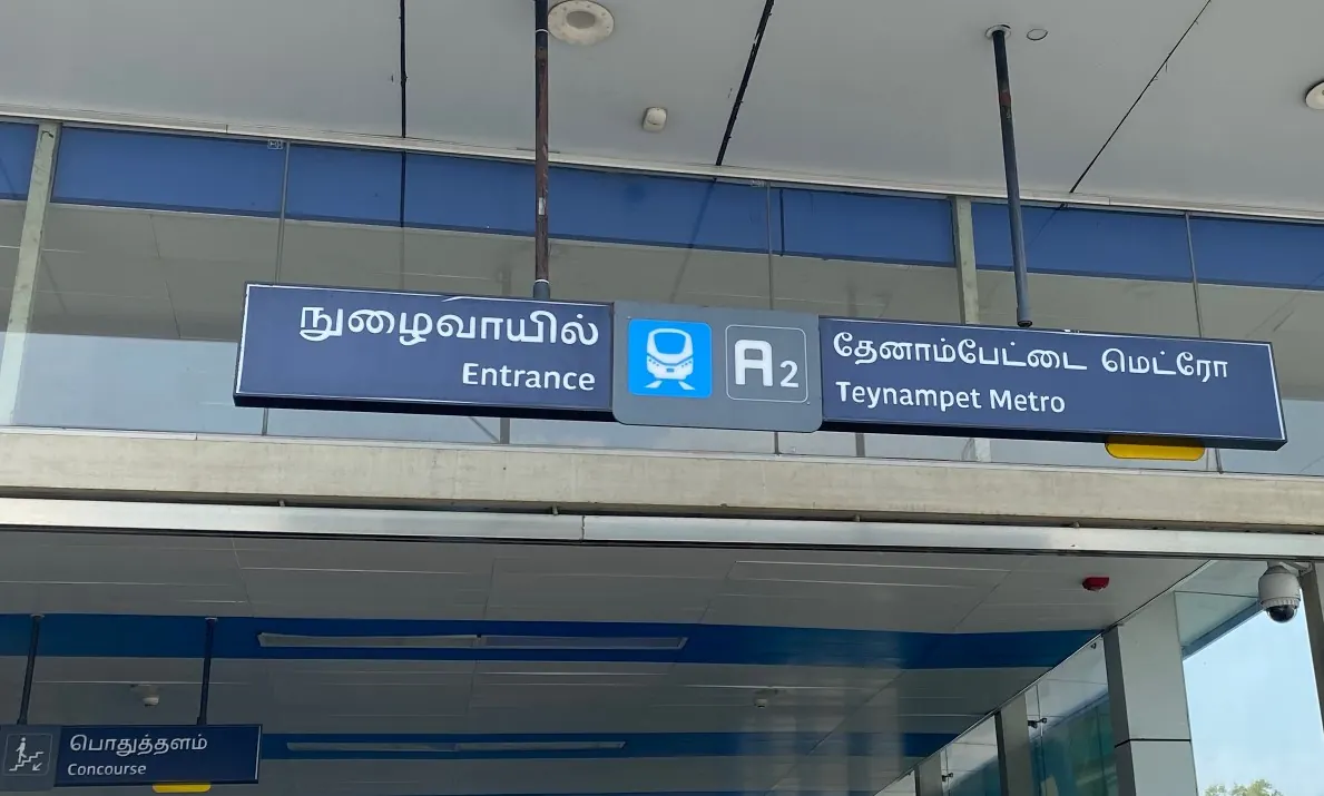
Nearest metro station to Nandalala Medical Foundation, Chennai
Teynampet is the nearest metro station to Nandalala Medical Foundation, about 1.7 km away, a walk of roughly 29 minutes.
Teynampet metro station on the Blue Line is the closest for Nandalala Medical Foundation, about 1697 m away, a walk of about 29 minutes. AG-DMS, also on the Blue Line, is about 2039 m away and Nandanam is about 2208 m away. Thousand Lights is the farthest of the four at about 2881 m. All four stops are on the Blue Line, so you will not need to change.
Mandaveli and Thirumayilai railway stations are both about 0.6 km from the foundation, the closest train options. Greenways Road railway station is about 1.8 km away. Mandaveli, Thirumayilai and Greenways Road all show 92 trains, so none stands out for trains. From Chennai Central, the ride to Teynampet takes about 12 minutes with no change. Corporation Hospital and Sri Ranga Hospitals are nearby landmarks.
Metro stations near Nandalala Medical Foundation
| Station | Distance | First / last metro |
|---|---|---|
| Teynampet Blue Line |
1.7 km 29 min walk |
05:13 to 23:38 |
| AG-DMS Blue Line |
2.0 km 35 min walk |
05:15 to 23:36 |
| Nandanam Blue Line |
2.2 km 38 min walk |
05:11 to 23:39 |
| Thousand Lights Blue Line |
2.9 km 50 min walk |
05:19 to 23:32 |
Straight-line distance from the Nandalala Medical Foundation map point; the walk along roads is longer, so walking times are estimates.
Map


Tips for getting to Nandalala Medical Foundation
- Teynampet on the Blue Line is the closest metro stop, about a 29 minute walk.
- All the nearby metro stations are on the Blue Line, so you do not need to change.
- From Chennai Central, Teynampet takes about 12 minutes by metro with no change.
- Mandaveli and Thirumayilai railway stations are each about 0.6 km away.
Metro to Teynampet (for Nandalala Medical Foundation) from popular stations
| From | Time | Changes |
|---|---|---|
| Chennai Central to Teynampet | 12 min | Direct |
| Chennai International Airport to Teynampet | 22 min | Direct |
| Arignar Anna Alandur to Teynampet | 12 min | Direct |
| St. Thomas Mount to Teynampet | 19 min | 1 |
| Vadapalani to Teynampet | 27 min | 1 |
| Wimco Nagar Depot to Teynampet | 38 min | Direct |
Nearest railway station to Nandalala Medical Foundation
| Railway station | Distance | Trains |
|---|---|---|
| Mandaveli (MNDY) | 0.6 km | 92 |
| Thirumayilai (MTMY) | 0.6 km | 92 |
| Mundakakanni Amman Koil (MKAK) | 1.3 km | 92 |
Straight-line distance. Train counts are trains that stop at the station in our timetable.
Nearest bus stand to Nandalala Medical Foundation
Nearest bus stand: Mylapore Bus Terminus, about 699 m away.
Straight-line distance; walking time adds a little for streets. Bus routes are from OpenStreetMap.
Questions about getting to Nandalala Medical Foundation
How far is Nandalala Medical Foundation from Teynampet metro station?
It is about 1697 m in a straight line, which is roughly a 29 minute walk.
Which metro line goes to Nandalala Medical Foundation?
The Blue Line. Teynampet, AG-DMS and Nandanam are all Blue Line stations nearby.
Which railway station is nearest to Nandalala Medical Foundation?
Mandaveli railway station and Thirumayilai railway station, each about 0.6 km away.
Which is the nearest metro station to Nandalala Medical Foundation?
Teynampet on the Blue Line (Chennai Metro) is the nearest metro station to Nandalala Medical Foundation, about 1.7 km away in a straight line, roughly a 29 minute walk.
Is there another metro station near Nandalala Medical Foundation?
Yes. AG-DMS is about 2.0 km away (Chennai Metro).
Which is the nearest railway station to Nandalala Medical Foundation?
Mandaveli (MNDY) is the nearest railway station, about 0.6 km away, with 92 trains stopping there.
Which is the nearest bus stand to Nandalala Medical Foundation?
Mylapore Bus Terminus is about 699 m from Nandalala Medical Foundation in a straight line.
Timings and fares: Chennai Metro Rail Limited (CMRL) (official site), checked 2026-11-15. Times at intermediate stations are estimates. Station locations: OpenStreetMap contributors. Not affiliated with any metro operator.
Place location: OpenStreetMap.