
Nearest metro station to Orkay, Mumbai
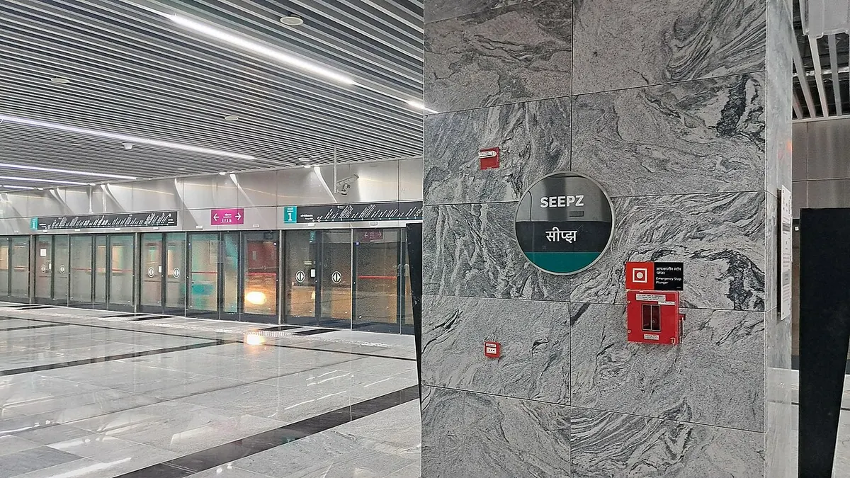
SEEPZ is the nearest metro station to Orkay, about 510 m away, a walk of roughly 9 minutes.
SEEPZ and MIDC - Andheri are the two closest metro stations to Orkay, about 510 m and 592 m away, a walk of about 9 and 10 minutes, and both are on Line 3 (Aqua Line). If you are travelling on Line 1 (Blue Line) instead, Chakala - J.B. Nagar and Airport Road are about 1088 m and 1352 m away, which take about 19 and 23 minutes on foot.
Andheri railway station is the nearest train option at 2.5 km, with 37 trains. Lokmanyatilak railway station is 6.1 km away and has the most trains, 168. Vidyavihar and Ghat Kopar railway stations are 5.5 km and 5.6 km away. From Ghatkopar, a ride to SEEPZ takes about 15 minutes with 1 change. St. John the Baptist Church and SEEPZ Bus Station are landmarks nearby.
Metro stations near Orkay
| Station | Distance | First / last metro |
|---|---|---|
| SEEPZ Line 3 (Aqua Line) |
510 m 9 min walk |
05:57 to 23:22 |
| MIDC - Andheri Line 3 (Aqua Line) |
592 m 10 min walk |
05:59 to 23:21 |
| Chakala - J.B. Nagar Line 1 (Blue Line) |
1.1 km 19 min walk |
05:41 to 00:01 |
| Airport Road Line 1 (Blue Line) |
1.4 km 23 min walk |
05:39 to 23:59 |
Straight-line distance from the Orkay map point; the walk along roads is longer, so walking times are estimates.
Map


Tips for getting to Orkay
- SEEPZ metro station is the closest, about 9 minutes on foot on Line 3 (Aqua Line).
- On Line 1 (Blue Line), use Chakala - J.B. Nagar, about 19 minutes on foot.
- Lokmanyatilak railway station has 168 trains but is 6.1 km away.
Metro to SEEPZ (for Orkay) from popular stations
| From | Time | Changes |
|---|---|---|
| Dahisar (East) to SEEPZ | 58 min | 2 |
| Ghatkopar to SEEPZ | 15 min | 1 |
| Gundavali to SEEPZ | 1 h 33 min | 3 |
| Hutatma Chowk to SEEPZ | 47 min | Direct |
| Airport Road to SEEPZ | 9 min | 1 |
| Andheri to SEEPZ | 15 min | 1 |
Nearest railway station to Orkay
| Railway station | Distance | Trains |
|---|---|---|
| Andheri (ADH) | 2.5 km | 35 |
| Vidyavihar (VVH) | 5.5 km | 3 |
| Ghat Kopar (GC) | 5.6 km | 4 |
| Lokmanyatilak (LTT) | 6.1 km | 165 |
Straight-line distance. Train counts are trains that stop at the station in our timetable.
Buses near Orkay
| Bus stop | Distance | Buses |
|---|---|---|
| Orkay 1 min walk | 5 m | 181, 307, 312, 319, 334, 349, 461LTDX, 496LTD and 6 more |
| C Cross Road 3 min walk | 166 m | 181, 307, 312, 319, 334, 349, 461LTDX, 496LTD and 6 more |
| Gautam Nagar 6 min walk | 319 m | 181, 307, 312, 319, 334, 349, 461LTDX, 496LTD and 6 more |
Nearest bus stand: SEEPZ Bus Station, about 560 m away.
Straight-line distance; walking time adds a little for streets. Bus routes are from OpenStreetMap.
Questions about getting to Orkay
What metro line goes to Orkay?
Line 3 (Aqua Line) serves SEEPZ and MIDC - Andheri, within about 592 m. Line 1 (Blue Line) serves Chakala - J.B. Nagar and Airport Road.
How far is Orkay from SEEPZ metro station?
It is about 510 m in a straight line, roughly a 9 minute walk.
Which railway station is nearest to Orkay?
Andheri railway station, about 2.5 km away with 37 trains.
Which is the nearest metro station to Orkay?
SEEPZ on the Line 3 (Aqua Line) (Mumbai Metro) is the nearest metro station to Orkay, about 510 m away in a straight line, roughly a 9 minute walk.
Is there another metro station near Orkay?
Yes. MIDC - Andheri is about 592 m away (Mumbai Metro).
Which is the nearest railway station to Orkay?
Andheri (ADH) is the nearest railway station, about 2.5 km away, with 35 trains stopping there.
Which buses stop near Orkay?
Orkay bus stop is about 5 m from Orkay, roughly a 1 minute walk. Routes 181, 307, 312, 319, 334 and 349 stop there in our data.
Which is the nearest bus stand to Orkay?
SEEPZ Bus Station is about 560 m from Orkay in a straight line.
Timings and fares: Multiple: Mumbai Metro One Pvt Ltd (Line 1), Maha Mumbai Metro Operation Corporation Ltd (Lines 2A, 2B, 7, 9), Mumbai Metro Rail Corporation Ltd (Line 3) (official site), checked 2026-10-03. Times at intermediate stations are estimates. Station locations: OpenStreetMap contributors. Not affiliated with any metro operator.
Place location: OpenStreetMap.