
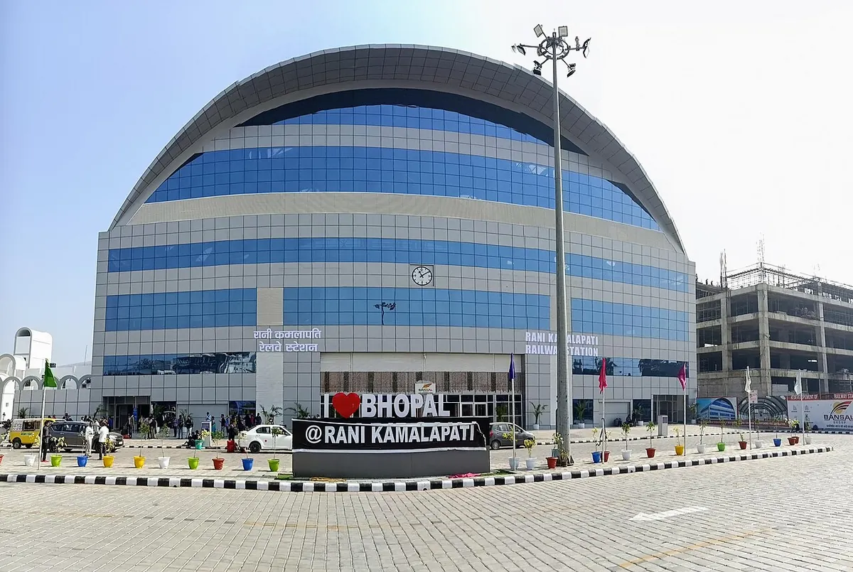
Nearest metro station to Parulkar Hospitals, Bhopal
Rani Kamalapati Railway Station is the nearest metro station to Parulkar Hospitals, about 827 m away, a walk of roughly 14 minutes.
Rani Kamalapati Railway Station metro station on the Orange Line is the nearest to Parulkar Hospitals, 827 m away, about 14 minutes on foot. MP Nagar metro station is 972 m away, around 17 minutes, so the two are a similar walk. Board Office Chauraha and DRM Office metro stations are 1378 m and 1389 m away, about 24 minutes each.
Bhopal Jn railway station is about 5.5 km away and has 264 trains, against 4 trains at Nishatpura railway station, 6.6 km away. For trains, Bhopal Jn is the sensible choice. From Alkapuri, the ride to Rani Kamalapati Railway Station metro station takes about 5 minutes with no change, and from AIIMS about 8 minutes. Arera Colony and Colony Hospital are nearby landmarks.
Metro stations near Parulkar Hospitals
| Station | Distance | First / last metro |
|---|---|---|
| Rani Kamalapati Railway Station Orange Line |
827 m 14 min walk |
11:41 to 19:38 |
| MP Nagar Orange Line |
972 m 17 min walk |
11:38 to 19:41 |
| Board Office Chauraha Orange Line |
1.4 km 24 min walk |
11:36 to 19:43 |
| DRM Office Orange Line |
1.4 km 24 min walk |
11:43 to 19:36 |
Straight-line distance from the Parulkar Hospitals map point; the walk along roads is longer, so walking times are estimates.
Map


Tips for getting to Parulkar Hospitals
- Rani Kamalapati Railway Station metro station is the closest, about 14 minutes on foot.
- MP Nagar metro station is 972 m away, a similar walk of about 17 minutes.
- From Alkapuri, Rani Kamalapati Railway Station metro station is about 5 minutes by train.
- Bhopal Jn railway station is about 5.5 km away and has 264 trains.
Metro to Rani Kamalapati Railway Station (for Parulkar Hospitals) from popular stations
| From | Time | Changes |
|---|---|---|
| DRM Office to Rani Kamalapati Railway Station | 2 min | Direct |
| MP Nagar to Rani Kamalapati Railway Station | 3 min | Direct |
| AIIMS to Rani Kamalapati Railway Station | 8 min | Direct |
| Subhash Nagar to Rani Kamalapati Railway Station | 11 min | Direct |
| Alkapuri to Rani Kamalapati Railway Station | 5 min | Direct |
| Board Office Chauraha to Rani Kamalapati Railway Station | 5 min | Direct |
Nearest railway station to Parulkar Hospitals
| Railway station | Distance | Trains |
|---|---|---|
| Rani Kamalapati (RKMP) | 0.9 km | 152 |
| Bhopal Jn (BPL) | 5.5 km | 265 |
| Nishatpura (NSZ) | 6.6 km | 4 |
Straight-line distance. Train counts are trains that stop at the station in our timetable.
Nearest bus stand to Parulkar Hospitals
Nearest bus stand: ISBT, about 1.6 km away.
Straight-line distance; walking time adds a little for streets. Bus routes are from OpenStreetMap.
Questions about getting to Parulkar Hospitals
What is the nearest metro station to Parulkar Hospitals?
Rani Kamalapati Railway Station metro station, about 827 m away, roughly a 14 minute walk.
Which metro line goes to Parulkar Hospitals?
The Orange Line. Rani Kamalapati Railway Station, MP Nagar, Board Office Chauraha and DRM Office metro stations are all on it.
How far is Bhopal Jn railway station from Parulkar Hospitals?
About 5.5 km, and it has 264 trains. Nishatpura railway station is 6.6 km away with 4 trains.
Which is the nearest metro station to Parulkar Hospitals?
Rani Kamalapati Railway Station on the Orange Line (Bhoj Metro (Bhopal Metro)) is the nearest metro station to Parulkar Hospitals, about 827 m away in a straight line, roughly a 14 minute walk.
Is there another metro station near Parulkar Hospitals?
Yes. MP Nagar is about 972 m away (Bhoj Metro (Bhopal Metro)).
Which is the nearest railway station to Parulkar Hospitals?
Rani Kamalapati (RKMP) is the nearest railway station, about 0.9 km away, with 152 trains stopping there.
Which is the nearest bus stand to Parulkar Hospitals?
ISBT is about 1.6 km from Parulkar Hospitals in a straight line.
Timings and fares: Madhya Pradesh Metro Rail Corporation Ltd (MPMRCL) (official site), checked 2026-10-03. Times at intermediate stations are estimates. Station locations: OpenStreetMap contributors. Not affiliated with any metro operator.
Place location: OpenStreetMap.