
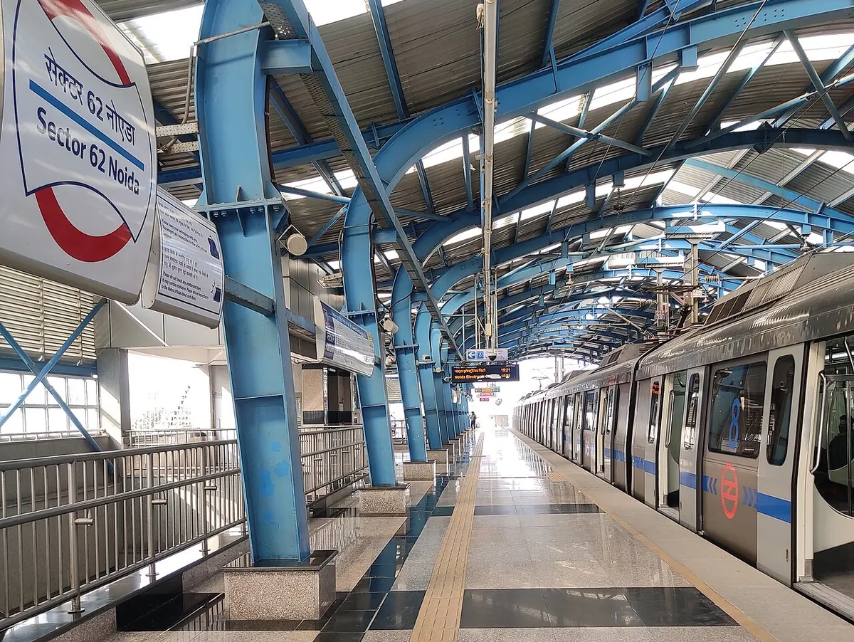
Nearest metro station to R.N. Hospital, Noida
Noida Sector 62 is the nearest metro station to R.N. Hospital, about 2.1 km away, a walk of roughly 37 minutes.
Noida Sector 62 on the Blue Line is the nearest metro station to R.N. Hospital, Noida, about 2.1 km away, with a walk of about 37 minutes. Noida Sector 59 is about 2.2 km away, a walk of about 38 minutes, and its Gate No. 1 is near U-FLEX. Noida Sector 61 and Noida Electronic City are both about 2.7 km away, each roughly 47 minutes on foot.
From Kirti Nagar, the ride to Noida Sector 62 takes about 60 minutes with no change. Anand Vihar railway station is about 5.3 km away with 38 trains. Anand Vihar Terminal railway station, about 5.4 km away, has the most trains nearby (160). Sector 55 Park Plaza and CDAC are landmarks close to the hospital.
Metro stations near R.N. Hospital
| Station | Distance | First / last metro |
|---|---|---|
| Noida Sector 62 Blue Line |
2.1 km 37 min walk |
05:52 to 22:52 station hours |
| Noida Sector 59 Blue Line |
2.2 km 38 min walk |
05:55 to 22:54 station hours |
| Noida Sector 61 Blue Line |
2.7 km 47 min walk |
05:57 to 22:56 station hours |
| Noida Electronic City Blue Line |
2.7 km 47 min walk |
see station |
Straight-line distance from the R.N. Hospital map point; the walk along roads is longer, so walking times are estimates.
Noida Sector 62 gates
- Gate No. 1: Towards Fortis Hospital
- Gate No. 2: Towards Noida Sec-63
Gate list from DMRC. Pick the gate on the R.N. Hospital side and follow station signs.
Map


Tips for getting to R.N. Hospital
- Noida Sector 62 metro station opens at 05:52 and closes at 22:52.
- Noida Sector 59 is on the Blue Line, about 2.2 km away, with a walk of about 38 minutes.
- Kirti Nagar to Noida Sector 62 is about 60 minutes with no change.
- Anand Vihar Terminal railway station has 160 trains, about 5.4 km from R.N. Hospital.
Metro to Noida Sector 62 (for R.N. Hospital) from popular stations
| From | Time | Changes |
|---|---|---|
| Kashmere Gate to Noida Sector 62 | 55 min | 1 |
| Inderlok to Noida Sector 62 | 1 h 10 min | 2 |
| Kirti Nagar to Noida Sector 62 | 1 h 0 min | Direct |
| New Delhi Airport Express Terminal to Noida Sector 62 | 56 min | 2 |
| Rajiv Chowk to Noida Sector 62 | 45 min | Direct |
| Anand Vihar to Noida Sector 62 | 45 min | 1 |
Nearest railway station to R.N. Hospital
| Railway station | Distance | Trains |
|---|---|---|
| Anand Vihar (ANVR) | 5.3 km | 38 |
| Anand Vihar Terminal (ANVT) | 5.4 km | 160 |
| Chander Nagar Halt (CNJ) | 5.8 km | 34 |
Straight-line distance. Train counts are trains that stop at the station in our timetable.
Nearest bus stand to R.N. Hospital
Nearest bus stand: Mayur Vihar Phase - 3, Bus Stand, about 1.4 km away.
Straight-line distance; walking time adds a little for streets. Bus routes are from OpenStreetMap.
Questions about getting to R.N. Hospital
What time does Noida Sector 59 metro station open?
It opens at 05:55 and closes at 22:54.
Which railway station is nearest to R.N. Hospital, Noida?
Anand Vihar railway station, about 5.3 km away, has 38 trains. Anand Vihar Terminal railway station is about 5.4 km away with 160.
Can I walk from Noida Sector 61 metro station to R.N. Hospital?
It is about 2.7 km in a straight line, so the walk is about 47 minutes.
Which is the nearest metro station to R.N. Hospital?
Noida Sector 62 on the Blue Line (Delhi Metro) is the nearest metro station to R.N. Hospital, about 2.1 km away in a straight line, roughly a 37 minute walk.
Is there another metro station near R.N. Hospital?
Yes. Noida Sector 59 is about 2.2 km away (Delhi Metro).
Which is the nearest railway station to R.N. Hospital?
Anand Vihar (ANVR) is the nearest railway station, about 5.3 km away, with 38 trains stopping there.
Which is the nearest bus stand to R.N. Hospital?
Mayur Vihar Phase - 3, Bus Stand is about 1.4 km from R.N. Hospital in a straight line.
Timings and fares: Delhi Metro Rail Corporation (DMRC) (official site), checked 2026-10-03. Times at intermediate stations are estimates. Station locations: OpenStreetMap contributors. Not affiliated with any metro operator.
Place location: OpenStreetMap.