
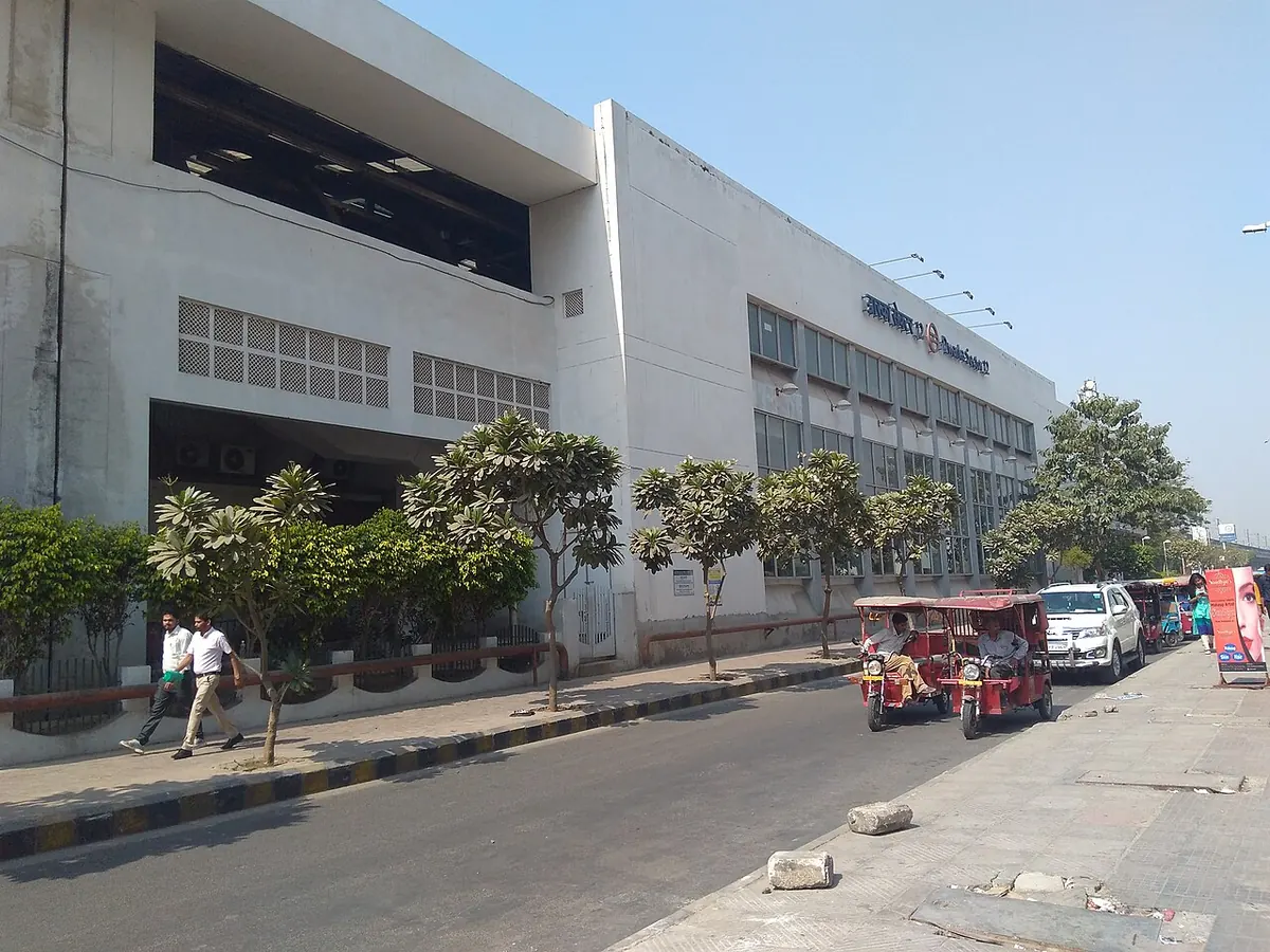
Nearest metro station to Raja Puri, Delhi
Dwarka Sector 12 is the nearest metro station to Raja Puri, about 1.9 km away, a walk of roughly 33 minutes.
Dwarka Sector 12 metro station is the nearest to Raja Puri, about 1903 m away on the Blue Line, roughly 33 minutes on foot. Dwarka Sector 11, Uttam Nagar West and Nawada metro stations are on the same line at 1997 m, 2008 m and 2092 m. All four are on the Blue Line, so you do not need to change to reach any of them.
Kirti Nagar reaches Dwarka Sector 12 metro station in about 33 minutes with no change, the simplest ride from there. Kashmere Gate takes about 60 minutes with one change, so it is the longer trip. Palam railway station is 4.2 km away with 34 trains, while Delhi Cantt railway station, 6.1 km away, has 95 trains. Madhu Vihar and Sector 3 Market are close by.
Metro stations near Raja Puri
| Station | Distance | First / last metro |
|---|---|---|
| Dwarka Sector 12 Blue Line |
1.9 km 33 min walk |
05:27 to 00:22 station hours |
| Dwarka Sector 11 Blue Line |
2.0 km 35 min walk |
05:29 to 00:24 station hours |
| Uttam Nagar West Blue Line |
2.0 km 35 min walk |
05:23 to 00:10 station hours |
| Nawada Blue Line |
2.1 km 36 min walk |
05:20 to 00:12 station hours |
Straight-line distance from the Raja Puri map point; the walk along roads is longer, so walking times are estimates.
Dwarka Sector 12 gates
- Gate No. 1: Service Road
- Gate No. 2: City Centre Mall
Gate list from DMRC. Pick the gate on the Raja Puri side and follow station signs.
Map


Tips for getting to Raja Puri
- Dwarka Sector 12 metro station is the shortest walk, about 33 minutes, on the Blue Line.
- Dwarka Sector 12 metro station opens at 05:27 and closes at 00:22.
- Kirti Nagar riders can reach Dwarka Sector 12 metro station with no change, in about 33 minutes.
- Delhi Cantt railway station has 95 trains, but it is 6.1 km away.
Metro to Dwarka Sector 12 (for Raja Puri) from popular stations
| From | Time | Changes |
|---|---|---|
| Kashmere Gate to Dwarka Sector 12 | 1 h 0 min | 1 |
| Inderlok to Dwarka Sector 12 | 47 min | 2 |
| Kirti Nagar to Dwarka Sector 12 | 33 min | Direct |
| New Delhi Airport Express Terminal to Dwarka Sector 12 | 35 min | 1 |
| Rajiv Chowk to Dwarka Sector 12 | 48 min | Direct |
| Anand Vihar to Dwarka Sector 12 | 1 h 13 min | 1 |
Nearest railway station to Raja Puri
| Railway station | Distance | Trains |
|---|---|---|
| Palam (PM) | 4.2 km | 34 |
| Shahabad Md.pur (SMDP) | 5.0 km | 24 |
| Delhi Cantt (DEC) | 6.1 km | 121 |
Straight-line distance. Train counts are trains that stop at the station in our timetable.
Buses near Raja Puri
| Bus stop | Distance | Buses |
|---|---|---|
| Raja Puri 1 min walk | 52 m | 727, 764 |
| Matiyala Crossing 6 min walk | 358 m | 727, 764 |
| Matiala Crossing 6 min walk | 366 m | 764 |
Nearest bus stand: DTC Bus Depot Sector 2, about 1.1 km away.
Straight-line distance; walking time adds a little for streets. Bus routes are from OpenStreetMap.
Questions about getting to Raja Puri
Which metro line goes to Raja Puri?
The Blue Line. Dwarka Sector 12, Dwarka Sector 11, Uttam Nagar West and Nawada metro stations are all on it.
What time does Uttam Nagar West metro station close?
It closes at 00:10 and opens at 05:23.
Which railway station is nearest to Raja Puri?
Palam railway station, about 4.2 km away, with 34 trains.
Which is the nearest metro station to Raja Puri?
Dwarka Sector 12 on the Blue Line (Delhi Metro) is the nearest metro station to Raja Puri, about 1.9 km away in a straight line, roughly a 33 minute walk.
Is there another metro station near Raja Puri?
Yes. Dwarka Sector 11 is about 2.0 km away (Delhi Metro).
Which is the nearest railway station to Raja Puri?
Palam (PM) is the nearest railway station, about 4.2 km away, with 34 trains stopping there.
Which buses stop near Raja Puri?
Raja Puri bus stop is about 52 m from Raja Puri, roughly a 1 minute walk. Routes 727 and 764 stop there in our data.
Which is the nearest bus stand to Raja Puri?
DTC Bus Depot Sector 2 is about 1.1 km from Raja Puri in a straight line.
Timings and fares: Delhi Metro Rail Corporation (DMRC) (official site), checked 2026-10-03. Times at intermediate stations are estimates. Station locations: OpenStreetMap contributors. Not affiliated with any metro operator.
Place location: OpenStreetMap.